


Voting District 0810024000004, Kent County, Michigan
About
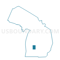
Outline

Summary
| Unique Area Identifier | 597286 |
| Name | Voting District 0810024000004 |
| County | Kent County |
| State | Michigan |
| Area (square miles) | 5.38 |
| Land Area (square miles) | 4.82 |
| Water Area (square miles) | 0.56 |
| % of Land Area | 89.65 |
| % of Water Area | 10.35 |
| Latitude of the Internal Point | 42.98554970 |
| Longtitude of the Internal Point | -85.53550530 |
Maps


Graphs
Select a template below for downloading or customizing gragh for Voting District 0810024000004, Kent County, Michigan


Neighbors
Neighoring Voting District (by Name) Neighboring Voting District on the Map
- Voting District 0810024000003, Kent County, MI
- Voting District 0810024000005, Kent County, MI
- Voting District 0810024000006, Kent County, MI
- Voting District 0810024000007, Kent County, MI
- Voting District 0810024000008, Kent County, MI
- Voting District 0811308000001, Kent County, MI
- Voting District 0813402000001, Kent County, MI
- Voting District 0813402000005, Kent County, MI
- Voting District 0813402000008, Kent County, MI
- Voting District 0813402000009, Kent County, MI
- Voting District 0816466000007, Kent County, MI
Top 10 Neighboring County Subdivision (by Population) Neighboring County Subdivision on the Map
- Plainfield charter township, Kent County, MI (30,952)
- Grand Rapids charter township, Kent County, MI (16,661)
- Cannon township, Kent County, MI (13,336)
- Ada township, Kent County, MI (13,142)
Top 10 Neighboring Place (by Population) Neighboring Place on the Map
Top 10 Neighboring Unified School District (by Population) Neighboring Unified School District on the Map
- Forest Hills Public Schools, MI (46,642)
- Rockford Public Schools, MI (39,467)
- Northview Public School District, MI (15,872)
Top 10 Neighboring State Legislative District Lower Chamber (by Population) Neighboring State Legislative District Lower Chamber on the Map
Top 10 Neighboring State Legislative District Upper Chamber (by Population) Neighboring State Legislative District Upper Chamber on the Map
Top 10 Neighboring 111th Congressional District (by Population) Neighboring 111th Congressional District on the Map
Top 10 Neighboring Census Tract (by Population) Neighboring Census Tract on the Map
- Census Tract 119.02, Kent County, MI (6,987)
- Census Tract 118.01, Kent County, MI (6,844)
- Census Tract 109.04, Kent County, MI (6,284)
- Census Tract 119.01, Kent County, MI (6,155)
- Census Tract 113.02, Kent County, MI (6,065)
- Census Tract 118.04, Kent County, MI (4,653)
- Census Tract 118.03, Kent County, MI (4,511)